Travel alert! Post-Christmas snowstorm set to dump up to 8 inches across NYC |
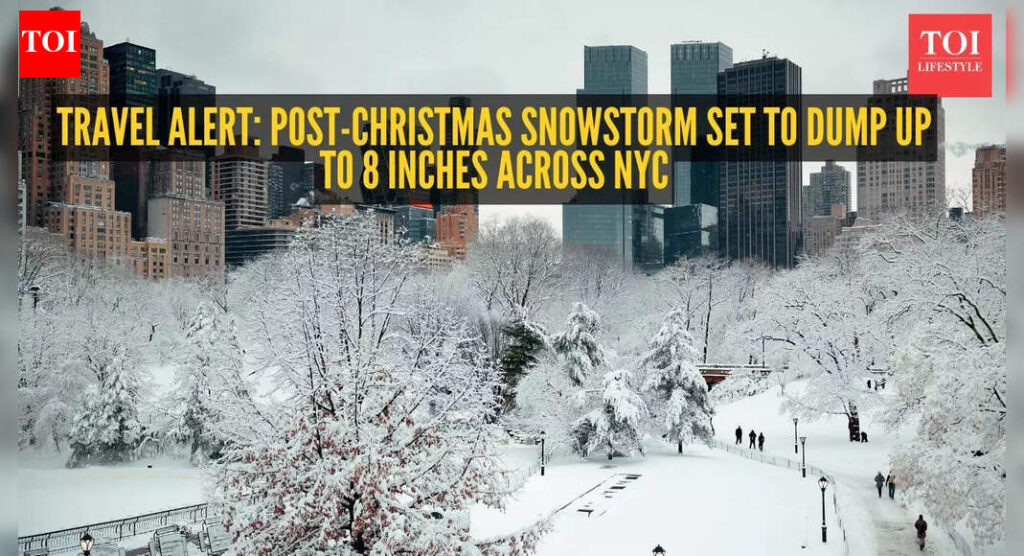
The holiday calm won’t last long for New Yorkers heading back to work or traveling this weekend. A fast-moving winter storm is expected to sweep through the city and surrounding areas after Christmas, bringing heavy snowfall and slick conditions that could disrupt commutes and make travel dangerous.Forecasters say New York City and the broader tri-state area will begin feeling the impact Friday afternoon, with snow continuing into early Saturday. While the storm arrives too late for a white Christmas, it is expected to hit squarely during peak travel hours.Parts of the city could see between three and six inches of snow, while higher totals are possible in surrounding areas. The Interstate 287 corridor between New Jersey and New York could receive as much as eight inches, AccuWeather senior meteorologist Tyler Roys told The Post.“For those who love snow in the city, there are some good signs pointing to there being accumulation,” Roys said. He added that sections of Long Island also cannot rule out snowfall totals approaching eight inches.Within the city, Manhattan, Queens, and Brooklyn are expected to land on the lower end of the forecast range, Roys noted. Snow is expected to begin causing problems around 3 p.m. Friday and taper off by around 10 a.m. Saturday.Forecasters are also watching the potential for sleet to mix into the storm, particularly to the south and west of the city, a factor that could worsen road conditions.“The likelihood of three to six inches is quite definite for the area,” Roys said. “So travel is going to be impacted basically starting with whatever the Friday evening commute … into the Saturday morning hours.”Roys added that the snowfall will likely be lighter and fluffier, making it less ideal for snowmen or snowball fights.Christmas Day itself is expected to remain snow-free but cold. Morning temperatures will hover around freezing, and breezy conditions are expected by early afternoon, Roys said. The day will stay dry, with a mix of sun and clouds.By nightfall, temperatures could dip into the upper teens in colder parts of the region, according to the forecast.